
Oman / Explore
Following an Omani Falaj: How Water Shares Turn a Channel Into a Community
A narrow irrigation channel can reveal an entire social landscape. Read an Omani falaj through the direction of its water, the timing of its shares and the people who keep it working, and a familiar heritage scene becomes a study in everyday cooperation.
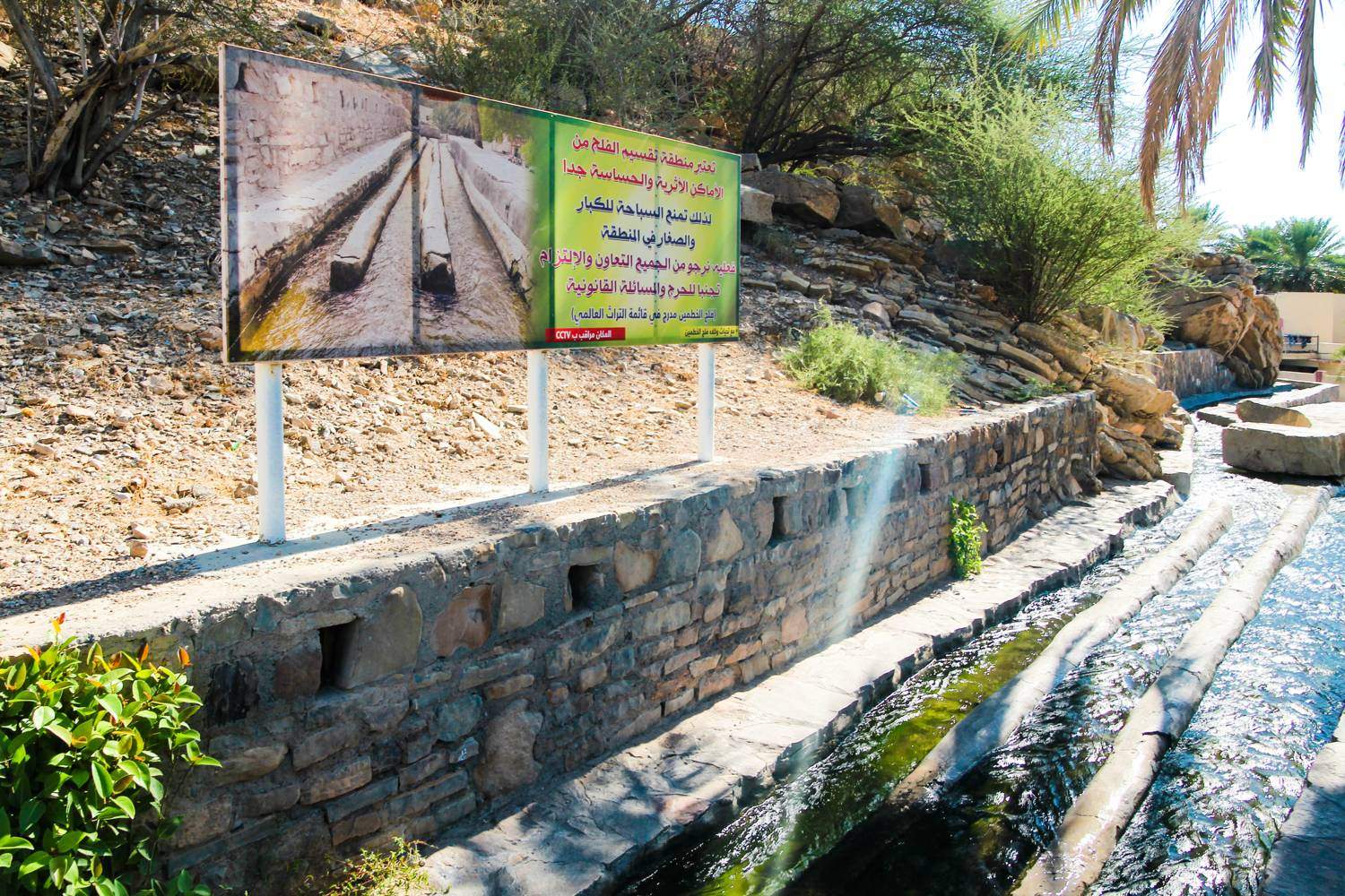
Begin with the direction of the water
A falaj can look modest: a narrow channel, a moving surface and a turn towards cultivated ground. Its significance becomes clearer when you ask where the water came from and who receives it next. The visible channel is one part of a system that connects a source, a route, agricultural land and a community’s arrangements for sharing. Following that relationship changes an Omani heritage visit from looking at old infrastructure to recognising a working agreement between people and place.
The University of Nizwa explains that a falaj draws water from a higher elevation and conveys it by gravity. This makes the shape of the land part of the engineering. From an accessible public path, look at the channel’s level, the position of nearby fields and the direction of movement. You do not need to trace the whole system physically to understand its basic logic: water has to arrive where it is useful, at a level that allows it to continue moving.
The landscape contains more than one kind of falaj
Omani aflaj are commonly grouped by their water source: aini, associated with springs; daoudi, drawing through underground channels; and ghaili, associated with surface water. The classification helps explain why one site may reveal a flowing open channel while another depends on infrastructure largely out of sight. A visitor should not assume that every falaj begins in the same way, or that the visible section reveals the complete route.
UNESCO’s World Heritage property brings together five systems: Al Jeela, Muyasser, Daris, Malki and Khatmein. They represent different but related working landscapes rather than five identical monuments. The designation includes the relationship between water, cultivation, settlement and management. A photograph of a channel can capture its surface beautifully, but a wider view that includes the fields and buildings usually explains more about why the channel is there.
Water is shared through time as well as space
The most revealing feature may be invisible during a short visit: the schedule. University of Nizwa scholar Abdullah Al-Ghafri describes the athar as a traditional unit used in allocating water shares. In a simplified calculation, a day contains 48 athar, making one equivalent to half an hour. His account also explains why actual arrangements are more complex, with differences between systems, seasonal daylight and changing flow. The familiar clock conversion is an introduction, not a complete description of local practice.
This changes how you interpret a junction or a closed diversion. Water reaching one plot while another waits need not mean that the second has been excluded. It may be someone else’s turn. A useful question for a knowledgeable local guide is how shares are recognised and how a turn is transferred into an actual flow. The answer can reveal a form of coordination that the stonework alone cannot show, including how people make an agreed entitlement visible in everyday work.
The channel needs an organisation behind it
Gravity moves the water, but it does not remove sediment, organise repairs or settle questions about distribution. The University of Nizwa emphasises that social cooperation is part of the system’s knowledge. Al-Ghafri describes an administrative structure that may include a wakil responsible for overall management and other roles concerned with maintenance, records and labour. The precise organisation varies with the size of the falaj; the important point is that continued flow depends on continuing responsibility.
That makes maintenance a cultural subject. A repaired edge or a modern intervention can be evidence of continued use rather than proof that heritage has disappeared. The useful distinction is between understanding what a change does and judging a site solely by how old every visible surface appears. Ask how repairs are agreed and supported. A living system has to remain usable for those who depend on it, even while its history and distinctive practices are conserved.
Read the cultivated ground as part of the system
The water’s purpose becomes concrete when you look beyond the channel to the ground it serves. Palm groves, paths and cultivated plots are not merely attractive surroundings for a heritage feature. They help explain the work that made permanent settlement possible in an arid environment. UNESCO treats the aflaj as cultural landscapes because water management and land use developed together. A channel separated from that setting tells only part of the story.
For your own observation, compare the scale of the watercourse with the area around it. Notice how small changes in level allow water to move towards a plot, and how paths keep people moving alongside the infrastructure. Do this from places where public access is clear. The most useful drawing or photograph may be a simple relationship: channel, branch, field and building. It records a sequence of use rather than collecting isolated picturesque details.
A working landscape also has pressures
The University of Nizwa identifies reduced groundwater availability and the loss of transmitted knowledge among the challenges facing aflaj. Its research approach connects hydrology with community life, recognising that conserving a channel alone cannot preserve every skill required to manage it. Water conditions, agricultural livelihoods and younger people’s opportunities all affect whether the system continues to be used. Its longevity is impressive, but it should not be mistaken for immunity to change.
For a visitor, this means avoiding an idealised story in which the past solved water management once and for all. A system can embody careful cooperation and still face difficult conditions. If someone discusses a change in flow or local practice, treat that as part of the heritage story. The aim is to understand how people respond to constraints, including new ones, rather than to make a working community illustrate a fixed image of timeless village life.
Leave with a better question
Treat a falaj as infrastructure in use. Keep out of the water, leave gates and diversions untouched, and avoid entering cultivated plots or private paths without permission. Ask before photographing people at work. These simple choices preserve the distinction between observing a system and interfering with it. A local explanation, when available, is more valuable than trying to infer ownership or custom from a brief glance.
The strongest memory of a falaj may be neither a spectacular structure nor a panoramic view. It may be the realisation that a narrow stream holds a network of obligations: someone maintains its route, someone knows the schedule, and someone depends on the next turn. Follow the water with those questions in mind and the landscape becomes easier to read. Oman’s aflaj reveal how engineering lasts when knowledge, responsibility and everyday use remain connected.
Gabriel Nicolaev – CyGuru