
UAE / Travel
Plan the Return Before the Summit: A Practical Way to Choose a UAE Mountain Hike
A route is only suitable if the whole group can complete the return under the conditions of the day. This feature uses official Ras Al Khaimah guidance to connect route choice, navigation, timing and a pre-agreed decision to turn back.
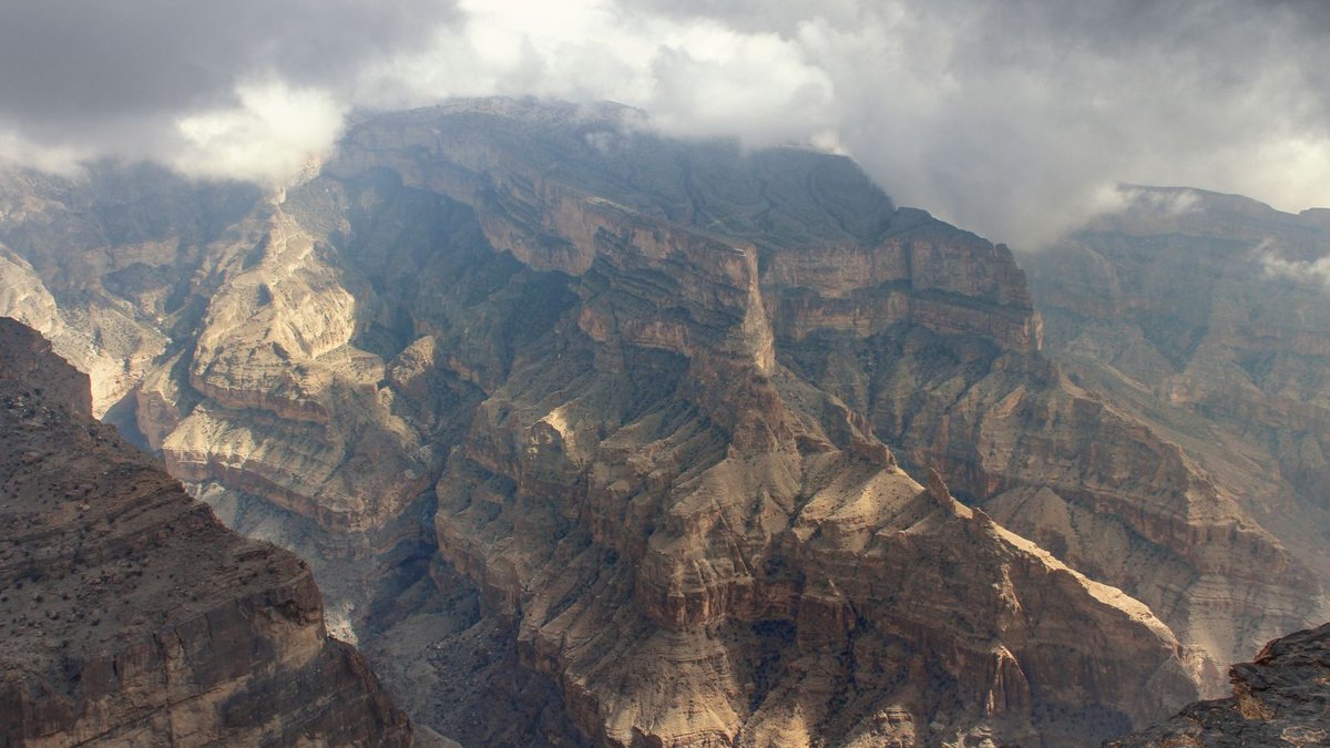
The endpoint is back at the start
A mountain photograph usually celebrates a viewpoint, but a hike is not complete there. The route still has to bring the group back to a known place with enough time and capability to manage the return. Planning around that complete journey changes the choice of trail. A destination that appears close on a map may require more effort or time than the group expects, while a modest route can provide a rewarding day without depending on everyone maintaining an optimistic pace. The useful measure is a manageable outing, not the greatest distance that can be fitted into a caption.
Official Jebel Jais mountain guidance from Ras Al Khaimah tourism authorities recommends preparation and navigation, while the destination’s hiking information advises hiking with a companion. These are starting points, not proof that every marked route is suitable for every visitor or open in all conditions. This feature offers a general planning method rather than a live route clearance or a substitute for a qualified guide. Before departure, check the current official trail information and weather guidance. Any closure or instruction from the responsible authority takes precedence over an itinerary saved earlier or a report from another visitor.
Choose for the whole group rather than its strongest member
A group’s practical pace is determined by the people completing the route together. Someone may be fit in a gym yet unfamiliar with uneven ground, exposure or a prolonged descent. Another may walk slowly but steadily over a full outing. An honest conversation about experience is more useful than a competitive declaration of fitness. Ask what each person has actually done, how recently and under which conditions. The aim is to choose a route the group can manage without one participant feeling pressured to hide discomfort because others have already committed to an ambitious destination.
The same principle applies to children and inexperienced adults. The ability to continue should not be inferred from enthusiasm at the car park. A suitable plan includes opportunities to reassess and a clear agreement that returning early is acceptable. This is not a prescription for a particular distance or a claim that one trail grade guarantees safety. Grades describe a route through a particular system; they cannot fully describe how a specific person will respond on a specific day. Where experience is limited, seeking advice from an appropriate local operator or qualified guide can help match the outing to the group.
Read distance together with terrain and elevation
A distance figure describes length, not the entire task. Ground surface, changes in elevation, exposure, route-finding and the character of the descent can alter the time and attention required. A route described casually online may omit the part that made it difficult for another person. Read the official route description and available map as a whole. Identify where the path begins, where it ends and whether the proposed walk returns by the same line or requires a different exit. Do not assume that a visible track provides an authorised or navigable connection to the place the group intends to reach.
Official Jebel Jais guidance recommends carrying a map with the route indicated, even where designated trails are marked. That advice reflects the difference between following occasional signs and understanding where the group is. A useful map review happens before movement begins: identify major features and the planned route rather than waiting until an uncertain junction to discover what the map shows. A phone can support navigation, but the plan should account for its limitations and the possibility that a service or battery is unavailable. The appropriate backup depends on the route and the group’s competence, not on the mere presence of a downloaded image.
Put the decision time into the plan
A turnaround point can be a time or a clearly identified location at which the group reassesses whether to continue. It should be chosen before enthusiasm and effort make retreat feel like losing an investment. The practical question is whether enough time and capacity remain for the return, including a reasonable margin for slower progress. This feature does not set a universal turnaround hour because daylight, weather and route demands differ. The value is agreeing the decision rule while everyone can consider it calmly, rather than negotiating it when one person is already tired and another wants to finish.
Consider a hypothetical group planning an out-and-back walk. It estimates the outward section using official information and its own experience, then sets a latest return decision that preserves time for the complete descent. If progress is slower than expected, it shortens the outward section rather than trying to recover the timetable by rushing. These are invented circumstances, not instructions for a named trail. The mechanism is what matters: the destination remains optional, while the return remains part of the commitment. A plan that allows only the best-case pace is an aspiration rather than a resilient itinerary.
Conditions can change the meaning of the route
Check the forecast and relevant official alerts for the place and time involved, not only the weather outside the hotel or home. Wind, visibility and rain can alter the suitability of an outing. A cooler season does not make every day interchangeable, and a clear morning does not guarantee conditions for the full route. The correct response to an official warning or closure is to change the plan accordingly. The exact action depends on the warning and the route; a general travel feature cannot provide clearance for a particular outing from a distance or override site instructions.
Preparation also includes the equipment and supplies appropriate to the activity, duration and conditions. Official destination guidance should inform the details, and a guide can clarify what is required for the chosen outing. Do not let attractive photographs substitute for that preparation. Clothing, footwear, navigation and the ability to communicate all need to fit the task. This article deliberately does not provide a universal water quantity or an individual medical assessment: needs vary, and health concerns belong with an appropriately qualified professional. The operating principle is to resolve important preparation questions before arriving at the trailhead.
Make the group understandable to someone outside it
A responsible plan lets an appropriate contact know where the group intends to go and when it expects to return, using the current route information rather than a vague description of a mountain range. Agree what to do if plans change and how the contact should respond if communication is missed. These arrangements should be realistic about signal limitations and the route. A contact who has no idea which trail was selected has less useful information than one who has the actual plan. This is general preparation guidance, not a claim that a message alone can replace equipment, skill or official emergency procedures.
Within the group, agree who is monitoring progress and ensure decisions are communicated to everyone. Splitting casually into fast and slow parties can turn a shared itinerary into two poorly defined ones. A companion’s presence is useful when people remain aware of one another rather than simply arriving in the same car. Where a professional guide is engaged, follow the guide’s instructions and clarify the plan before starting. The point is not to make an ordinary walk bureaucratic. It is to remove uncertainty that becomes harder to solve once people are separated or uncertain about where the others have gone.
Judge success by the complete day
After returning, compare the plan with what happened: the pace, navigation decisions, equipment and points at which the group reassessed. This review need not become a performance ranking. Its value is to make the next choice more realistic. A route that took longer than expected supplies information about future timing; turning around supplies information about the margin the group needs. Sharing that experience responsibly means describing conditions and limits rather than announcing that a route is easy for everyone. Personal success is evidence of one outing, not a guarantee for the next visitor.
The strongest UAE mountain plan joins an appropriate route, current information, a capable group and a clear return decision. The summit or viewpoint remains an attractive possibility, while the full journey determines what the group can responsibly attempt. Official destination guidance provides a foundation; local conditions and the people taking part determine how it is used. A good day in the Hajar Mountains does not require the most ambitious line on the map. It requires a choice the group understands, with enough room to revise it before the return becomes difficult. Gabriel Nicolaev – CyGuru
Gabriel Nicolaev – CyGuru
Sources & further reading
Jebel Jais: official mountain safety guidance
Visit Ras Al Khaimah: hiking guidance
Visit Jebel Jais: current hiking information